
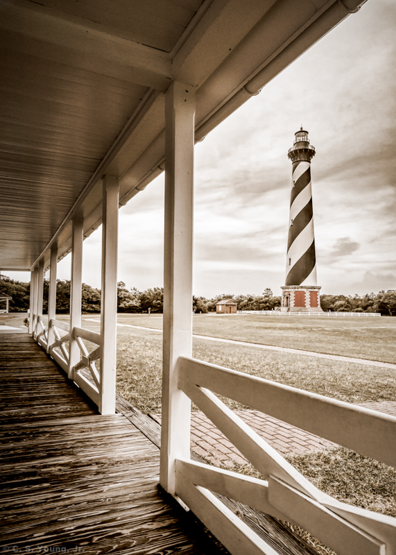
At 210 ft tall, the Cape Hatteras Lighthouse is the tallest brick lighthouse in the United States, and second tallest in the world. Just off the cape, the warmer Gulf Stream collides with the colder Labrador Current creating shifting sandbars and powerful ocean storms. The resulting Diamond Shoals and surrounding areas have claimed over 5000 ships and countless lives.

Since 1871, in it’s second incarnation, the lighthouse has helped mariners navigate around these treacherous waters. By the 1990s however, the encroaching sea was just 15 feet, (4.6 m) from the lighthouse foundation. In 1999, the structure was moved 2,990 ft (880 m) and is now 1,500 ft, (460 m) from the current shoreline.
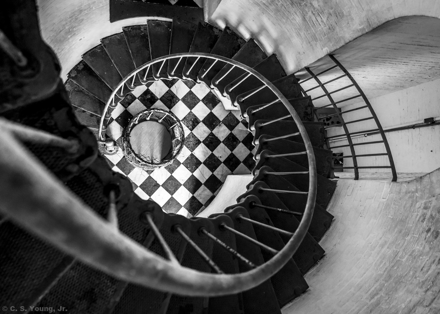
During my exploration and study of the lighthouse interior, I sent members of my Scout party ahead with direction not to wait on me. I intended to use two legs of my tripod along with the wall or railing to squeeze out a few additional stops of depth of field. Unfortunately, tripods are not allowed inside the lighthouse. Keeping my ISO between 800 and 1200, I was able to get satisfactory captures with my Tamron 15mm-30mm wide angle at f2.8.


I have several additional compositions from Cape Hatteras to share in my next post. Click on an image to see the high resolution versions of this iconic structure. Have a great week!
Cheers,
C. S.

nice post
LikeLiked by 1 person
Thank you, appreciate your feedback!
LikeLike
Beautiful captures and look forward to your next post on the lighthouse!
LikeLike
Hi Angela, thank you for your comment, hope to post the additional picks this Wednesday ot Thursday. Cheers!
LikeLiked by 1 person
I always enjoy shots like these, very nice.
LikeLiked by 1 person
Thanks Ted, the Outer Banks lighthouses are so iconic. Especially when folks learn about the number of shipwrecks in the “Graveyard of the Atlantic” and the role of the lighthouse in mitigating the risk of sailing these waters before GPS.
LikeLiked by 1 person